CO14ers

Hello, Sawatch by Dani Perrot

Labor Day weekend = A free Monday for Dierker. Unemployment = A free Monday for Dani. We figured a long weekend called for ticking some boxes off of the 14er list, so we headed to Leadville and the Sawatch for a few days after skiing St. Mary's on Saturday

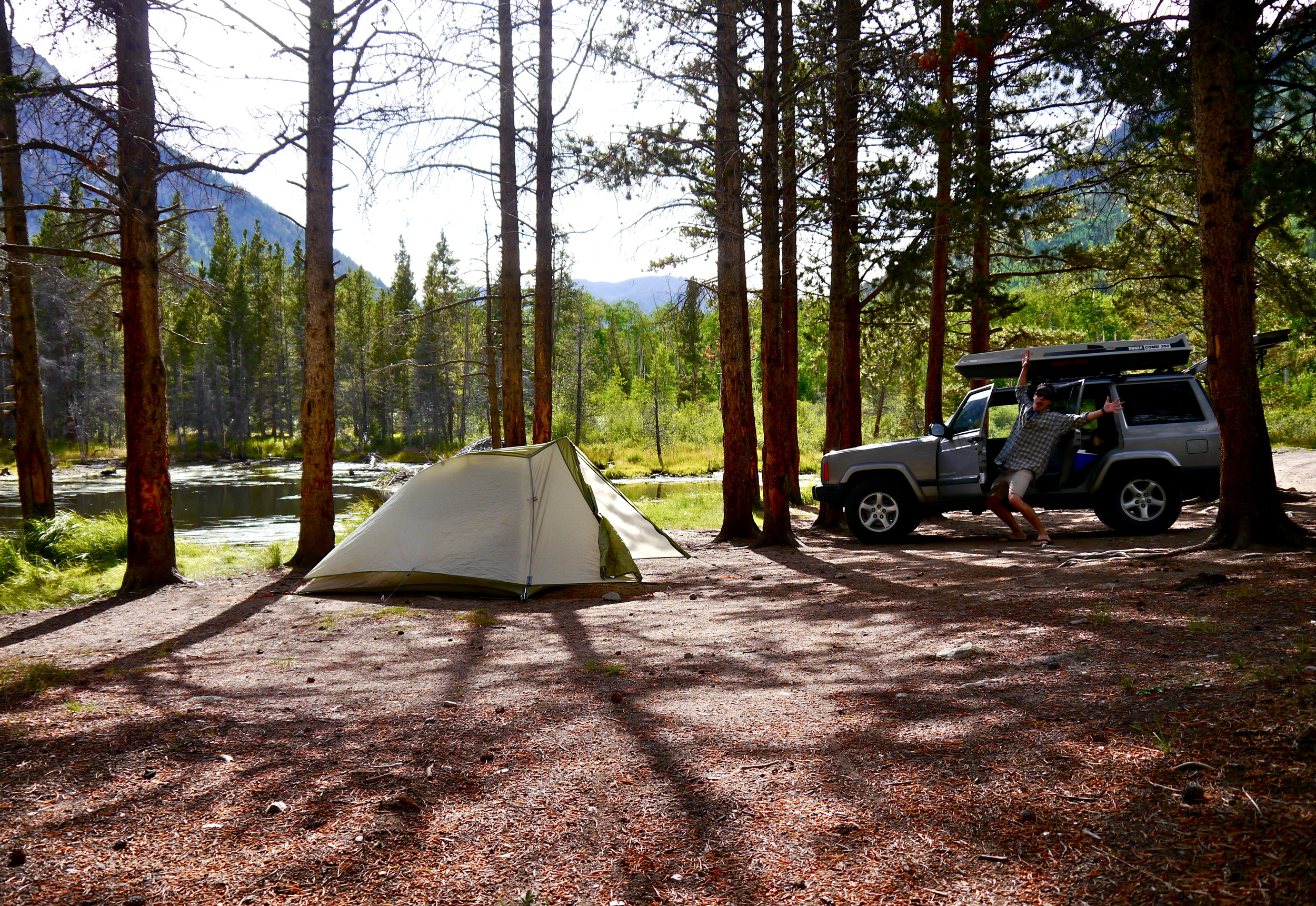
We found a nice spot to camp up CR 390, which was close to two trailheads that provide access to the higher peaks. It was looking like weather was iffy for Sunday and good for Monday, so we settled on jiking Huron on Sunday. 

HURON

We left the car around 6 from the S. Winfield trailhead, and mostly ran up the 4WD road toward the real start to the climb on the Huron Peak trail (making good time, averaging 10 min/mile). Once above treeline, the temperature dropped and we both regretted only having shorts and a few thin running jackets. Luckily, both of us had heavy duty gloves. The wind was MOVING and some rain clouds were beginning to group and close in. Dani was having a rough day already, and the conditions didn't help. Neither one of us could feel our feet, hands, legs, faces...we summited Huron (14,003 ft) at about 2 hrs, 30 mins from the car, snapped some quick photos, and got the hell out of there. We got back to the car at 10:20. Not too bad. It was a beautiful morning, but also much more brutal than we had anticipated-- something more clothes probably would have helped. 

We drove to Leadville to get some huge mugs of coffee from City on a Hill and make plans for Sunday. We decided on doing a loop on Missouri, Oxford, and Belford-- a long day, but doable. We decided we'd hike it, since clearly we needed to carry more layers, food, and water than we had for Huron. Back at camp, we munched on breadsticks for dinner and played cards in the tent while the weather spat outside. 

MISSOURI, OXFORD, BELFORD

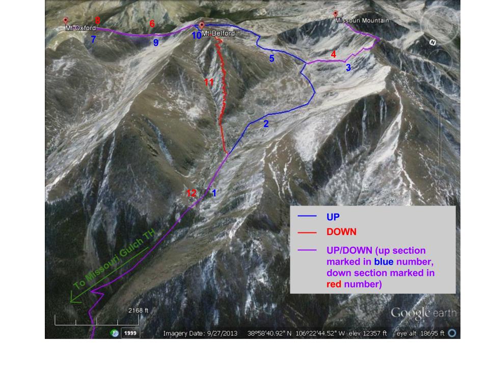
Round trip distance: 15 mi, Total vertical elevation gained: 7,414 ft

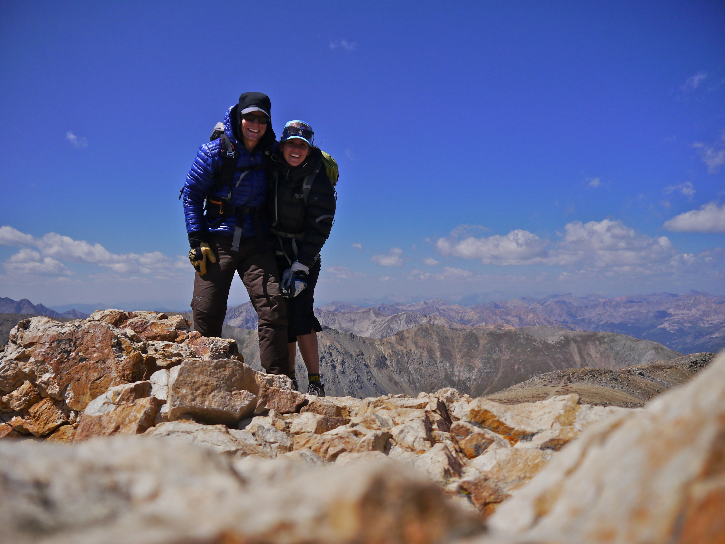
We left the car at 4:15 and were the first people on top of Missouri by 8:00 AM. We headed back down to Missouri Gulch and up Elkhead Pass and the shoulder of Belford toward Oxford, and were down and up Oxford by 11:05. We summited Belford and had lunch by noon, and were back at the car by 2:30. Not bad! Most notable were the many pikas (see shoddy photo of one below), beautiful yellowing alpine tundra, and the gale-force winds that persisted from treeline (5 AM) and for the rest of the day (not pictured). It was a long day, but we had some recovery burgers in Leadville and were back home in Boulder by 7:30. 

Missouri Mountain: 14,067 ft | Mt Oxford: 14,153 ft | Mt Belford: 14,197 ft

    [Click on photo to enlarge, hover cursor for captions.]

    Thanks Sawatch! Great weekend.

    XOXO

    d&d

    DECALI by Dani Perrot

    This past weekend, we did the De-Ca-Li Loop: Democrat (14,148 ft), Cameron (14,238 ft), and Lincoln (14,286 ft). 

    We slept in the back of the Subie at Montgomery Reservoir on Friday night under some pretty intense moonlight. The next morning, we left the car at 4 AM and began up the 4WD track toward the North Ridge of Democrat. Once into talus and scree up around 12,000 ft, the sun came up and we had some great early morning light. I did this ridge with friends several years ago, and it was still fun as ever. The CO wind whipped around as we dipped below gendarmes, climbed out of notches, and negotiated choss. The best part about the N. Ridge of Democrat is that it isn't listed on 14ers.com, so (1) there are no humans, (2) there are no cairns, (3) you can see all of the humans coming up the trail across the basin from you. It was fun to pop out of "nowhere" into a crowd. From there, we took the trail to the top of Cameron and Lincoln with all of the other humans. The comraderie on the 14ers is a pretty excellent thing, and we marched onward and upward with our fellow ants.

    The wind was WHIPPING up high, so we scooted quickly off the top of Lincoln down to Lincoln Ampitheater, again away from the crowds. About halfway down the east slope, Alex spotted something...it was a canvas sign from the running store Vertical Runner in Breckenridge. What the what?! It looked like it had been up there for a long time, so we rolled it up to take back to town with us. [We did briefly consider keeping it as a wall decoration for our new apartment.] I don't know if I'd call the loose scree on the way down "fun", but it was definitely a great workout for the balance and the ankles. The clouds had built up by the time we were above the Lincoln Icefall (in the summertime, a waterfall), and the sky was spitting here and there. I had anticipated this next 500ish ft down to the car as the trickiest part of the day (when Morgan, Scott, and I did it a few years ago, it was snowy and Scott found a way down across ledges by working far east)...unfortunately, I was right. We tried maybe six different ways and kept getting cliffed out. The route description says this is Class 2 (aka basically walking off-trail), and we kept working our way up and down through thick, brushy trees and willows with no luck. I was starting to panic as thunder rumbled nearby and Alex began craving those beers in the car we could see below us. Finally, we tried staying close to the Icefall, and we managed a way down through the cliffbands. WHEW! I don't think we were exactly on-route, but who cares. 

    After beer and sandwiches, we bombed back to Breck and returned the sign to a super grateful Ryan Morgan at Vertical Runner (turns out the sign had blown off the top of Mt. Lincoln during a race, over a year ago). Not bad a bad way to spend a Saturday morning. CO: we're excited for you.

    [Click on photos to enlarge, hover cursor for captions.]

    Dierker's First Fourteener by Dani Perrot

    As most know, we are moving to Colorado in a few weeks; while we were in Boulder last weekend for Alex's job interviews, we took a few hours to go jike* Bierstadt (standing just above 14,000 ft) Saturday morning. Almost all of Denver seemed to be there, but Dierker and I still had a fantastic time with the masses. First of many!

    *jike = jog-hike